
Buôn Đôn
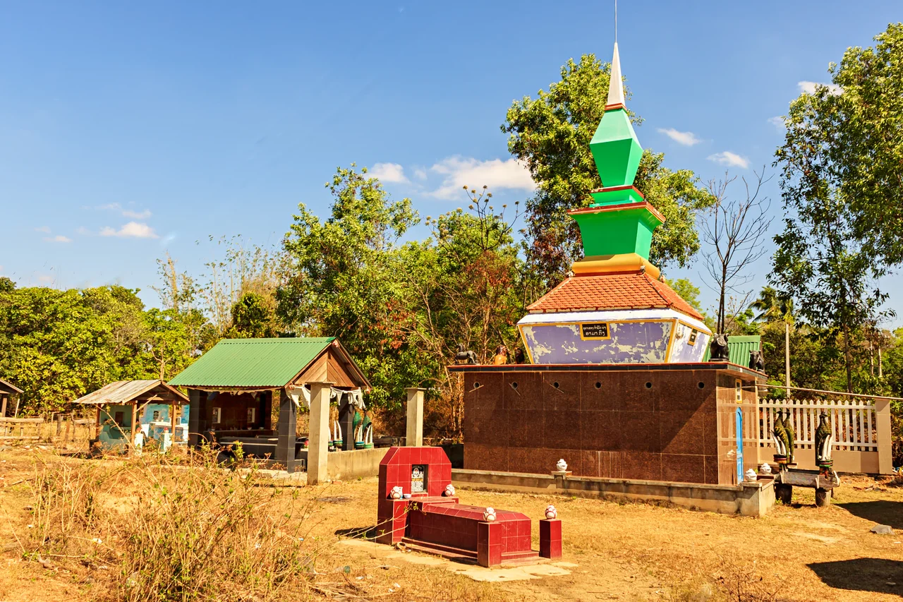
Two brick tombs stand in a forest cemetery near the Srepok River, and neither of them looks quite Vietnamese. One carries a stepped spire borrowed from Khmer temples; the other mixes Mnong and Lao motifs into something the guidebooks struggle to categorise. Beneath them lie the two most celebrated elephant catchers in the country's history - N'Thu K'Nul, whom the Siamese court titled Khunjunob, the Elephant King, and his successor R'leo K'Nul. The architecture is the argument. Buôn Đôn was never a straightforwardly Vietnamese place, and its dead were not going to be buried as though it were.
The Village of the Isle
The name comes from Lao, not Vietnamese: Băn Dón, rendered Buôn Dôn in the Rade language, meaning roughly "the village of the isle." It refers to a small stone bund in the Srepok, and to the Lao merchants who came upriver in the nineteenth century to trade and then simply stayed. They married into Ede families. Their children grew up switching between Lao, Thai and the local highland tongues depending on who was standing in the room. The Srepok itself runs the wrong way for Vietnamese geography - west, across the Cambodian border, eventually feeding the Mekong - and for a long time the river was the road. Goods, languages and marriages travelled it in both directions, which is why a village eight hours from the coast ended up with a Siamese royal title in its family history.
One Hundred and Seventy Elephants
N'Thu K'Nul is credited with capturing and taming more than 170 wild forest elephants over his lifetime, among them a white elephant he sent as a gift to the king of Siam - the gesture that earned him the Khunjunob title. Catching an elephant meant riding a trained one into the herd and roping a calf with a rawhide lasso, at close quarters, in thorn forest, with the mother very much present. His stilt house still stands in the village, built in Lao style from heavy forest timber; local accounts say it took nearly three years to raise and cost ten grown elephants to pay for. The village still races elephants on the tenth day of the third lunar month. What it no longer does is put tourists on their backs: the riding operations at Ban Don have been discontinued, a change that arrived late but arrived.
Khộp Forest
West of the village the ground opens into khộp - dry dipterocarp woodland, thin-canopied and grassy underfoot, which burns and regreens on a seasonal rhythm and looks more like African savanna than anyone expects of Vietnam. Yok Đôn National Park was established here in 1991 to protect 582 square kilometres of it and now covers 1,155. It runs right up against Cambodia's Mondulkiri Protected Forest, forming part of what may be the largest protected-area complex in Southeast Asia, and it shelters 474 recorded vascular plant species. It is also a ledger of losses. Indochinese tiger, leopard, gaur and wild elephant are all on the park's species list; all have declined severely. The forest that made the elephant catchers famous is now mostly notable for how few elephants are left in it.
A District That Isn't
Buôn Đôn spent three decades as a rural district of Đắk Lắk - 1,414 square kilometres, a capital at Ea Wer, one township and seven communes, and a population that climbed from 56,238 in 2003 to 63,816 by 2018. Then Vietnam rewrote its map. On 1 July 2025 the country abolished the district tier of government entirely, collapsing 63 provinces into 34 and pushing administration straight from province to commune. Buôn Đôn the district ceased to exist. Two weeks earlier, on 16 June, the neighbouring commune of Krông Na had been renamed Buôn Đôn, inheriting the name if not the boundaries. That commune covers 1,113.79 square kilometres - reported as the largest by area in Vietnam - and holds 6,582 people. Roughly five residents per square kilometre, most of the rest being forest and the Cambodian frontier.
From the Air
Buôn Đôn sits at 12.904°N, 107.739°E on the western edge of the Đắk Lắk Plateau, terrain generally 200-400 m AMSL and falling away toward Cambodia. Buon Ma Thuot Airport (BMV / VVBM, elevation 529 m, single 3,000 m runway 09/27) lies roughly 50 km east-southeast and is the only practical field in the region. From 4,000-6,000 ft the Srepok River is the primary visual reference, running west into Cambodia, with the unbroken khộp forest block of Yok Đôn National Park filling the ground north and west of the river. The Cambodian border is only about 25 km west - check airspace before tracking that way. Dry season (November-April) gives the best visibility, though agricultural and forest burning can drop it sharply in March; the May-October monsoon brings afternoon buildups over the plateau.
Nearby Stories
- Chư Yang Sin National Park 18 km away
- Sen Monorom 23 km away
- Duc Lap Camp 27 km away
- Bidoup Núi Bà National Park 34 km away
- Chu Pong Massif 44 km away
- Lake Yeak Laom 65 km away
- Bù Gia Mập National Park 79 km away
- Camp Radcliff 98 km away