.jpg)
Gia Lai province
The Jarai did not have kings in a sense Hanoi or Angkor would have recognised. What they had were the Pötao — the King of Fire, the King of Water and the King of Wind — figures of spiritual rather than political authority, keepers of a sacred sword their cosmology says descended from heaven. They commanded no army and levied no tax; what they were held to influence was rain, harvest and the balance of things. A French missionary recorded meeting a King of Fire in 1850. The province laid over their country carries a version of the name they use for themselves: Gia Lai, from the Jarai Yăgrai, a word bound up with the water dragon.
Seven Hundred Metres Up
Gia Lai sits on the northern shelf of Vietnam's plateau country, averaging 700 to 800 metres above sea level — high enough that mornings arrive cool and misty even in the tropics, low enough that the afternoons remind you where you are. The soil is the deep red basalt that defines the whole region, and it shows: the roads run rust-coloured, the dust settles rust-coloured on everything, and after rain the whole landscape looks freshly painted.
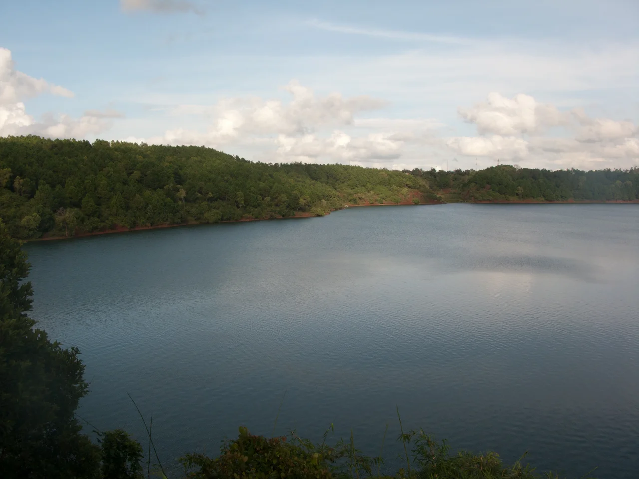
The old provincial heart is Pleiku, at about 740 metres. North of it lies Biển Hồ, the Sea Lake, a volcanic crater filled with water and ringed by pines. Hàm Rồng — Dragon Mountain — rises to 1,092 metres just south of town, its summit ridge the rim of a long-extinct crater. Waterfalls come thick in the wet season: Phú Cường in the old Chư Sê district, Xung Khoeng out toward Chư Prông and the Cambodian border, where Gia Lai meets Ratanakiri.
A House You Enter Through Your Mother
Around 460,000 Jarai and 189,000 Bahnar live in Gia Lai, alongside a Kinh majority that has grown steadily since the twentieth century. The Jarai language belongs to the Chamic branch of Malayo-Polynesian — a cousin of Cham and Ê Đê, and evidence of the seafaring ancestry that carried Austronesian speakers to this coast long before they climbed inland. Roughly half a million Jarai live in Vietnam and another twenty-seven thousand across the border in Cambodia's Ratanakiri, where they make up close to a quarter of the population. The frontier drawn by France in the nineteenth century runs straight through the middle of them.
Jarai society is matrilineal. A daughter stays in her mother's house and her husband moves in; property and standing descend through women, and it is the mother who sets her daughters' marriages in motion. The Bahnar, their Bahnaric-speaking neighbours, build the tall thatched rông — communal houses whose roofs rear up like axe blades over the village, visible from a long way off across the plateau.
Letting the Dead Go
Highland funerals here do not end at the grave. The dead are given a small tomb house stocked with their possessions and offerings, and for years afterwards the living keep bringing food and drink and news, tending the grave as though the person were only away. The dead are still present, still owed something.
The release comes at the tomb abandonment ceremony, an expensive and communal affair involving buffalo or cattle, gong ensembles and days of feasting. Only then is the relationship formally closed: the spirit is freed to go on, the family's obligation is discharged, and the tomb is left to the forest. It is a way of grieving that gives mourning a fixed end and a public witness — something many funeral traditions never quite manage.
The Province That Doubled
In 2025 the map changed underneath all of this. Under Resolution 202/2025/QH15, Vietnam cut itself from sixty-three provinces to thirty-four, and Gia Lai absorbed the coastal province of Bình Định. The merged province kept the highland name but moved its administrative centre to Quy Nhơn, a port city on the South China Sea, and the result is a province of 21,576 square kilometres and more than 3.58 million people — the second-largest in the country by area, and one that now runs from the Cambodian border all the way to the beach.
Pleiku, the highland city that had been the provincial capital, lost its municipal status on 1 July 2025 and was reorganised into five wards and two communes reporting directly to the province. Its 435,000-odd residents woke up in the same place under a different arrangement. The city remains the economic and cultural centre of the uplands; it simply no longer has a city's paperwork.
What this means on the ground is still settling. A province whose identity was built on coffee, rubber, pepper and the highland peoples now also owns fishing fleets, container berths and a coastal tourism industry — two very different economies filed under one name.
Getting There
Two airports now serve the merged province. Pleiku (PXU) sits on the plateau at 744 metres, a single 2,400-metre runway handling daily flights to Hanoi and Ho Chi Minh City and a weekly connection to Da Nang. Phu Cat (UIH), the larger field, serves Quy Nhơn and the coast, and traces its own lineage to a wartime air base.
Overland, Highway 14 runs the spine of the highlands north to Kon Tum and south to Buôn Ma Thuột, while Highway 19 climbs east over the Mang Yang and An Khê passes toward the sea — the same road French and later American convoys fought to keep open, and now the artery binding the province's two halves together.
From the Air
Pleiku lies near 13.98°N, 108.00°E; the province now stretches east to Quy Nhơn on the coast near 13.77°N, 109.22°E. The plateau averages 700–800 metres with Hàm Rồng at 1,092 metres just south of Pleiku, so set minimum safe altitudes accordingly on approach from the east. Best viewing is 6,000–10,000 feet: the red basaltic ground, the geometric blocks of coffee and rubber estate, the circular crater lake of Biển Hồ north of the city, and the abrupt eastern escarpment where Highway 19 drops through the Mang Yang and An Khê passes toward the sea. Airports: Pleiku (VVPK/PXU), elevation 2,441 ft, single asphalt runway 09/27 of 2,400 m; Phu Cat (VVPC/UIH) on the coastal side. Clearest flying is the November-to-April dry season; the southwest monsoon from May to October brings low cloud on the plateau and vigorous afternoon convection over the escarpment.
Nearby Stories
- Operation Sam Houston 20 km away
- Sê San Dam 21 km away
- Camp Radcliff 22 km away
- Operation Crazy Horse 23 km away
- Kon Tum 34 km away
- Sông Cầu 64 km away
- Buôn Hồ 78 km away
- Dak Dam 127 km away