
Minden Aqueduct
Stand on the right embankment at the right moment and you can watch a loaded barge sail over a river. The Weser runs north through Minden at the bottom of its valley. The Mittelland Canal crosses the town from west to east about thirteen metres higher up, carried straight over the water in a steel trough set on piers. Two ships can pass each other at right angles here without ever meeting, one of them in the sky. Germany has exactly two waterway crossings built on this principle. The other, at Magdeburg, is bigger and far younger. This one has been working since 1914, and the whole apparatus around it - two bridges, two link canals, four locks, an industrial harbour and a set of pumps that run all year - exists to solve a single stubborn problem: a canal needs a level surface, and a river refuses to hold still.
Why the Canal Had to Fly
The Mittelland Canal was cut to join three river systems - the Ems in the west, the Weser in the middle, the Elbe in the east - into one continuous inland route across northern Germany. At Minden it meets the Weser at an awkward angle and an awkward height. Canal water has to sit at a fixed level; river water rises with the snowmelt off the Harz and drops in a dry August. Locking the canal down into the Weser and back up again would have made every east-west transit hostage to the river's mood, so the engineers did the other thing and carried the canal over the top. What they could not do was ignore the Weser entirely, because Minden's harbours and the river traffic still had to connect. Two short link canals, north and south of the crossing, drop shipping from one waterway to the other through locks. The result is a junction rather than a bridge - a place where boats change altitude.
The 1914 Trough
The first canal bridge over the Weser went up between 1911 and 1914: 370 metres of mass concrete carrying a channel twenty-four metres wide at the water surface and three metres deep. It served for three decades. On 4 April 1945, with Allied troops closing on the town from the south, retreating German forces blew it up along with nearly every other bridge in Minden - a demolition ordered under Hitler's scorched-earth Nero Decree, and one that delayed the Canadian paratroopers who took the town centre that same evening by almost nothing. Rebuilding took from 1947 to 1949, and the repaired bridge reopened on 18 February 1949. It carried commercial traffic for another four decades. Today no cargo crosses it. Walkers do.
Ships Outgrew It
The trouble was arithmetic. A channel sized for the barges of 1914 could not take the 110-metre motor freighters that came to dominate German inland shipping, and a canal is only as generous as its narrowest point. Work on a second, parallel bridge began in October 1993, and it opened on 25 August 1998 at a cost of around 85 million marks. It is a steel structure rather than a concrete one: 398 metres overall, with a welded trough 341 metres long holding a channel forty-two metres wide and four metres deep - nearly twice the width of its neighbour and a third deeper. The two bridges now sit side by side, one in service and one retired, which makes the crossing unusually easy to read from the air.
Thirteen Metres Down
Getting a ship from the canal to the river is the harder engineering. The original answer was the Schachtschleuse, the shaft lock, built alongside the first bridge between 1911 and 1914 and handling a drop of up to 13.20 metres in a chamber eighty-two metres long and ten wide - extended to eighty-five metres in a rebuild in 1988 and 1989. Sixteen water-saving basins are stacked around it on four levels, catching water on the way down so it can be reused on the way up. It was not enough for modern vessels either, and in the spring of 2017 a new Weser lock opened next to it, 139 metres long and 12.5 metres wide, moving 25,000 cubic metres of water in a single cycle. The northern link canal runs 1.2 kilometres, the southern 1.3, and between the southern locks lie Minden's industrial port and the entrance to the old Weser harbour with its shut-down shipyard.
Where the Water Comes From
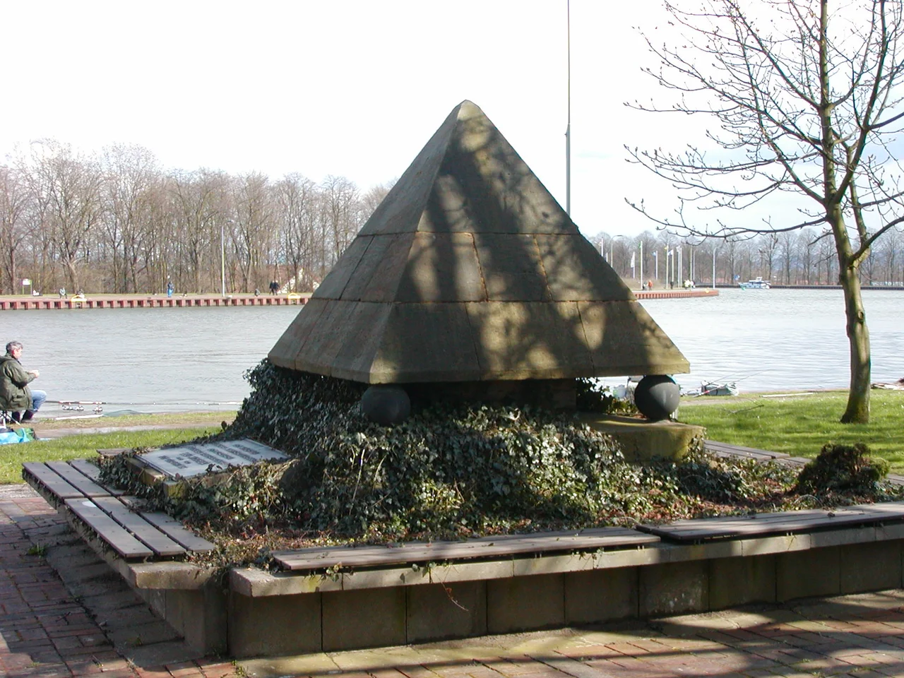
Every lockage spills canal water downhill into the Weser, and gravity does not return it. Somebody has to put it back. Two pumping stations at the crossing lift water from the river to the canal continuously, and over a year they move around 58 million cubic metres - a river of its own, running uphill in pipes. An information centre at the crossing explains how the locks work to anyone who wants to know, and a pyramid-shaped memorial on the bank remembers Leo Sympher, the Prussian hydraulic engineer who planned the Mittelland Canal as the country's main west-east waterway and died in 1922, before the last stretch of it was finished.
From the Air
The Minden Aqueduct sits at 52.3031N, 8.9317E, in the northern part of Minden in North Rhine-Westphalia, and it is one of the cleaner geometric landmarks in the region: a canal running dead straight west to east, a river winding north, and the two crossing at right angles with visible parallel bridges at the intersection. The two link canals and the harbour basins show as short bright fingers north and south of the crossing. From 1,000 to 2,500 feet AGL the whole junction fits in one frame, and low sun angles pick out the shadow line of the steel trough. Porta Westfalica airfield (EDVY, 860 m asphalt, elevation about 45 m) lies roughly 10 km to the south-west and is the natural base for a low look. Hannover (EDDV) is about 60 km east; Muenster/Osnabrueck (EDDG) roughly 60 km west. The Weser valley here is flat and low - the river leaves Minden at about 40 m elevation - so haze and river fog are common on still mornings, and the Wiehen Hills rising to 272 m south-west of town are the terrain to watch.
Nearby Stories
- Schöma 6.8 km away
- Meller Möbelfabrik 12 km away
- RAF Gütersloh 15 km away
- Hermannsdenkmal 16 km away
- Electorate of Hanover 17 km away
- Fagus Factory 23 km away
- Ahlden House 23 km away
- Diepholz 41 km away