
Banlung
In the dry season everything in Banlung ends up the same colour. The laterite roads throw off a fine rust-red dust that settles on motorbike tanks, on cashew leaves, on the plastic chairs outside the market, on the white shirts of schoolchildren by mid-morning. It gets into the seams of your bag and stays there for weeks. The town has taken its palette from the ground it sits on, and so has the province it governs: Ratanakiri comes through Khmer from the Sanskrit ratna, gem, and giri, mountain. Gemstone mountains. The red is ancient basalt weathered down over hundreds of thousands of years, and the gems, as it happens, are not a metaphor.
Gemstone Mountains
Blue zircon is what Ratanakiri actually produces — the most abundant stone in the province by a wide margin, with smaller quantities of amethyst, blue sapphire and peridot coming out of the same ground. Most of it is still won by hand, in shallow pits worked by families rather than by machinery, though commercial operations have been expanding. The same volcanic history that scattered the gems laid down the province's other asset: a hilly basalt plateau whose deep red soils are unusually fertile, which is why rubber, cashew and oil palm plantations keep pushing outward from the roads. As of 2015 some 78 percent of Ratanakiri was still forested. That figure has been the subject of anxious arithmetic in Cambodia for two decades, and it is the reason so much of what happens around Banlung is about land.
A Capital Named in 1979
Banlung has been the capital of Ratanakiri only since 1979, and before that it was not even called Banlung — the settlement was known as Labansiek. The province itself was carved out of eastern Stung Treng in 1959, administered first from Lumphat and later from Veun Sai. What happened in between is why the map was redrawn. The Khmer Rouge moved its headquarters into Ratanakiri in 1966, and the province was on the receiving end of a massive covert United States bombing campaign between March 1969 and May 1970. From June 1970 the Khmer Rouge held the province outright. When the regime fell, the administration that reassembled itself did so at Labansiek, on higher ground with better road access, and gave the place a new name. Almost nothing standing in Banlung today predates that decision.
Small Town, Enormous Province
Banlung proper holds around 17,000 people, and the whole municipality counted 30,399 at the 2019 census — a modest population for the administrative seat of nearly 11,000 square kilometres. Life orbits a roundabout and a market where villagers from across the province come to sell. Power arrives from the O Chum 2 hydropower dam, but only around 13 percent of homes in the region are connected to the grid, so generators and quiet evenings are still the norm. The road situation has transformed: Highway 78 runs 70 kilometres east to the O Yadaw crossing and on to Pleiku in Vietnam, and the route south to Stung Treng and Phnom Penh is now sealed the whole way, an eight-hour bus rather than a two-day ordeal. The airfield is a gravel strip. No scheduled airline serves it.
Reasons to Leave the Roundabout
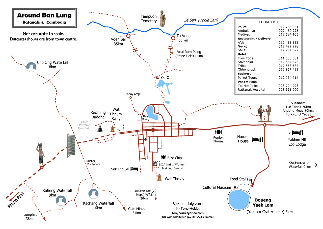
Nobody comes to Banlung for Banlung. Five kilometres out sits Yeak Laom, the volcanic crater lake managed by Tampuan community elders, and three kilometres west the Katieng waterfall drops into a pool you can swim in; Cha Ong is a short ride away in the other direction. Virachey National Park runs north toward the Lao border. The province is home to Tampuan, Jarai, Kreung, Brao, Kachok and Kavet communities among others, and visiting their villages is not a matter of turning up. Ceremonies close villages to outsiders, and the signs are there to read — fresh leaves hung at a gate mean stay out. Photographs need permission, freely asked and freely refused. A local guide is not a convenience here so much as basic courtesy, and the guesthouses around the roundabout will arrange one in an afternoon.
From the Air
Banlung sits at 13.747°N, 107.004°E, at roughly 300 m elevation on Ratanakiri's basalt plateau in north-eastern Cambodia. From the air the town reads as a rust-red grid of laterite roads against dark forest and plantation blocks, with the near-perfect green disc of Yeak Laom crater lake 5 km to the south-east serving as the best single landmark in the province. Ratanakiri/Banlung airport (VDRK) is an unpaved strip with no scheduled traffic and no instrument approach; Stung Treng (VDST) lies about 65 nm west and Phnom Penh International (VDPP) roughly 320 nm south-west. Visual conditions are best from December to February. The May–October monsoon delivers 250–300 mm a month between June and September with strong afternoon convection, and March–April agricultural burning can reduce visibility to a few kilometres in haze.
Nearby Stories
- Đức Cơ Camp 5.4 km away
- Virachey National Park 30 km away
- Yali Falls Dam 33 km away
- Srepok River 38 km away
- Stung Treng 60 km away
- Buôn Đôn 72 km away
- Khong Island 75 km away
- Sambor Wildlife Sanctuary 117 km away